The Ice Age Trail is Wisconsin’s gift of the glaciers.
By Eric Sherman
The Ice Age Trail is a thousand-mile hiking trail, entirely within the state of Wisconsin. It is one of only eleven National Scenic Trails, receiving its NST designation from Congress in 1980.
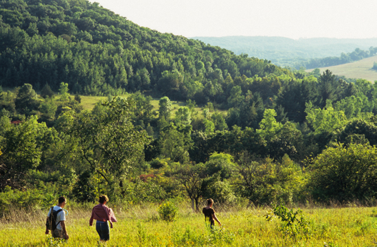
The theme of the Trail is Wisconsin’s world-renowned Ice Age legacy. The last wave of glaciers retreated from the state 10,000 years ago. Therefore the evidence of how continental ice sheets sculpted our planet is relatively fresh here. The Trail is a living textbook of glacial geology; as one explores the Ice Age Trail more and more, Wisconsin’s glacial heritage reveals itself through landscape features like moraines, kettles, eskers, drumlins and erratics.
An interest in glacial geology is not a prerequisite for hiking on the Ice Age Trail, however. While Wisconsin’s modern landscape may lack the drama of towering mountain peaks or the geological freakshows of the U.S. Southwest, it is filled its own charms, subtle yet stirring – quiet forests, thriving prairies, rolling terrain and Wisconsin’s remarkable freshwater resources. Four distinct seasons give the Ice Age Trail four different looks, inviting year-round exploration. (As one enthusiast stated, the Trail is not a thousand miles long but 8,000, when accounting for two directions across four seasons.) Wisconsin, and the Ice Age Trail, have a way of hooking those who invest the time to explore the wonderful natural resources at hand.
For those planning a trip to check out the Ice Age Trail, and especially for those planning a long-distance hike, there are several pertinent concepts to keep in mind:
A Work In Progress
The Ice Age Trail is a work-in-progress. As described in the Ice Age Trail Companion Guide 2008, a helpful resource published by the Ice Age Trail Alliance (IATA), the current Ice Age Trail route is 1099.5 miles between its eastern terminus in Door County, Wisconsin (on Lake Michigan) and its western terminus on the Wisconsin-Minnesota border. Of that total, 620.2 are signed miles, while 479.3 are unsigned (connecting route) miles.

Breaking down those 1099.5 miles another way, 467.0 are “traditional” hiking trail miles, 103.2 are multi-use path miles and 529.3 are road and sidewalk miles.
Although volunteers work hard through the IATA to construct new off-road segments as land is acquired on which to build them, Ice Age Trail “completion” is likely decades in the future. Those interested in a thru-hike at this time should prepare for quite a bit of walking on quiet country roads, which can be a treat in and of itself, giving hikers an intimate look at Wisconsin’s rural culture.
Limited Accommodations
Trailside dispersed camping options are relatively limited. Although the northern portion of the Ice Age Trail passes through the huge tracts of public land (county and national forests) that lend themselves well to backpack-camping, much of the rest of the route crosses property types (municipal land, private property, smaller state and county parks) where pitching a tent alongside the Trail is typically not permitted. Long-distance hikers in some areas will need to venture off the route of the Trail for overnight accommodations.
While the Ice Age Trail Alliance is working hard to increase the number of dispersed camping options, at this time a long-distance hike on the Trail requires a little more planning than needed for a jaunt on more developed trails. The above-mentioned Companion Guide is a big help. In some ways an even bigger help to backpackers is the Ice Age Trail Atlas, also published by the IATA, which is a book featuring more than 100 detailed color maps of the Trail. The maps feature a particular pattern of shading to indicate where dispersed trailside camping is allowed, essential info for anyone planning a multi-day Ice Age Trail adventure.
Lots Of Resources Available
Speaking of those volunteers, the IATA has 21 different volunteer chapters along the route of the Ice Age Trail. Coordinators of each chapter (whose contact info is posted at www.iceagetrail.org) can be terrific resources for assessing local conditions at a particular time of year, as well as offering advice on where to stay at each point along the Trail route. Many coordinators and other chapter volunteers embrace the role of “Trail Angels”, assisting long-distance hikers with shuttling, food and lodging.

Many resources are available to help hikers navigate the Ice Age Trail. The best place to start if you are considering an Ice Age Trail excursion is to call the Ice Age Trail Alliance (800-227-0046). Staff members can listen to your ideas for your trip and help shape an adventure just right for what you are seeking.
Those who you speak with at the IATA will undoubtedly point you toward the organization’s website, www.iceagetrail.org. The site is stuffed with information on planning a trip, and includes free, downloadable Companion Guide excerpts and regional maps to help get you started. Volunteers from local chapters also weigh in online with updates on Trail conditions, highlighting reroutes, closures and newly constructed segments not included in the latest editions of the Companion Guide and Atlas.
Fans of the Ice Age Trail come to appreciate it from a variety of perspectives, whether that of a long-distance hiker, a weekend day-hiker, a geology buff, a nature lover, or one who simply enjoys being involved with a project that engages so much “sweat equity” from volunteers while giving so much to the outdoor recreation community. Regardless of your perspective, with a little advanced planning, a visit to the Ice Age Trail will undoubtedly give you a strong appreciation for Wisconsin and its remarkable gift of the glaciers.

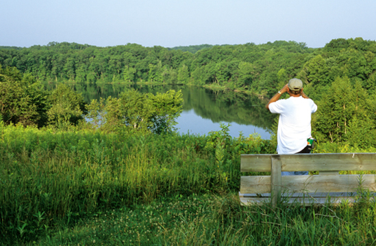
Top of Page: Image of Dumke Lake in Chippewa County Wisconsin. Photo By Eric Sherman

